In a time of tremendous technological advancement, the geospatial environment is experiencing a radical metamorphosis that is opening previously unimaginable possibilities and changing the way we perceive the world. To transform the way we see, evaluate, and work with geographical data, this article examines nine essential elements that are at the forefront of reshaping the geospatial world today.
- Advanced Satellite Technology
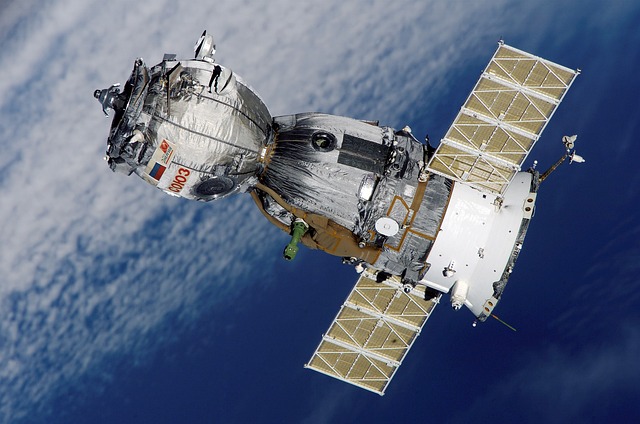
Advanced satellite technologies largely shape modern geospatial technology. Our capacity to see and map the Earth has been transformed by satellites that are outfitted with sensors with high resolution and advanced imaging capabilities. Real-time data is provided by these satellites for a range of uses, such as agriculture, urban planning, disaster relief, and weather monitoring. The ongoing progress in satellite technology has a substantial impact on our comprehension of the dynamic spatial aspects of the globe.
- Geographic Information Systems (GIS)
Geographic Information Systems (GIS) constitute the backbone of geospatial technology. By integrating spatial data, geographic information systems (GIS) enable users to study, understand, and display intricate geographic data. GIS is essential to many different sectors, such as public health, environmental management, and urban planning, from mapping tools to spatial analytics. Managers in a variety of industries find GIS to be an invaluable tool due to its adaptability and capacity to overlay disparate information.
- Global Positioning System (GPS)
The Global Positioning System (GPS) has a significant impact on the geospatial environment and has become an essential element of our everyday life. GPS offers precise position monitoring and navigation on a worldwide scale. GPS has revolutionized the way we see and use geographical data, from directing people through urban streets to streamlining logistics and transit routes. GPS technology is always being upgraded, which leads to more accuracy and more applications—from augmented reality to driverless cars.
- LiDAR Technology
High-precision spatial data may now be captured with greater ease because of the development of light detection and ranging (LiDAR) technology. LiDAR measures distances and produces intricate 3D maps of the Earth’s surface using laser light. Archaeology, urban planning, forestry, and mapping are among the fields in which this technique is used. LiDAR is a crucial tool for forming the geospatial landscape because of its capacity to record fine details and height data, which sheds light on the properties of the terrain and structural elements.
- Uncrewed Aerial Vehicles (UAVs)
Drones, or uncrewed aerial vehicles, have revolutionized the way we gather geographical data. UAVs with cameras and sensors are useful for applications like mapping, agriculture, and building inspection because they can take very detailed aerial photos. UAVs are widely used in many different industries because of their accessibility and adaptability, which adds a new level of flexibility to the collection of geographical data.
- Cloud-Based Geospatial Platforms
Access to geographical data and analytic tools has become more accessible with the introduction of cloud-based geospatial platforms. These systems provide cooperative, scalable settings for handling, storing, and exchanging geographic data. Users may collaborate in real-time on geospatial projects from multiple places with cloud-based solutions. Companies of all sizes are able to leverage the value of geographical data thanks to this accessibility, which also quickens the speed of geospatial innovation.
- Spatial Data Analytics
The process of obtaining valuable insights from geographical datasets is known as spatial data analytics. This field looks for patterns, geospatial industry trends, and correlations in geographical data using sophisticated statistical and machine-learning approaches. For well-informed decision-making in fields like corporate intelligence, disaster management, and urban planning, spatial data analytics is essential. Complex geographical interactions become easier to grasp when spatial data is analyzed and useful insights are extracted.
- Augmented Reality (AR) and Virtual Reality (VR)
Your interactions with and perceptions of spatial information are changing as a result of augmented reality (AR) and virtual reality (VR). AR improves spatial awareness by superimposing digital data over the physical world. Users are fully submerged in virtual reality worlds. These technologies are useful for immersive experiences that support visualization of space and decision-making in urban planning, construction, and education.
- Internet of Things (IoT) Integration
Our capacity to gather and process geographical data in real time is improved by the Internet of Things (IoT) integration with geospatial technology. Sensor-equipped Internet of Things devices continuously feed location-specific data. Precision agriculture, environmental monitoring, and smart city programs all benefit greatly from this combination. The combination of IoT and geospatial technology broadens the application of spatial insights and promotes more effective and sustainable spatial management.
Conclusion
Thanks to technological developments that improve our capacity to monitor, evaluate, and comprehend the spatial features of our environment, the geospatial landscape is still changing quickly. These essential elements—which range from satellite technology and GIS to cutting-edge developments like augmented reality and IoT integration—combine to create a dynamic and networked geospatial environment. The combination of these technologies unlocks new avenues for innovation in tackling global issues and utilizing geographical data for a sustainable future, allowing us to navigate this dynamic world and discover new possibilities.


